Admissions data 2021
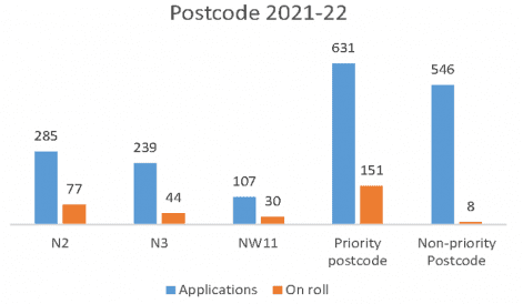
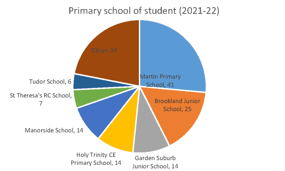
The following charts will give you some information about our 2021 intake.
All data correct as of 26 September 2021.
Catchment area (2021 intake)
The chart and maps below reflect the places offered to children for September 2021 on the basis of geographical proximity only, for places offered to each of our three priority postcodes. These should not be taken as a firm indication for future years.
They do not include places offered within other criteria, such as siblings, children with special educational needs or those in local authority care (which accounted for 62 places in total).
The furthest distance from school to home for a student for each priority postcode is set out in the chart below. These figures show students that were offered and accepted a place at the school only.
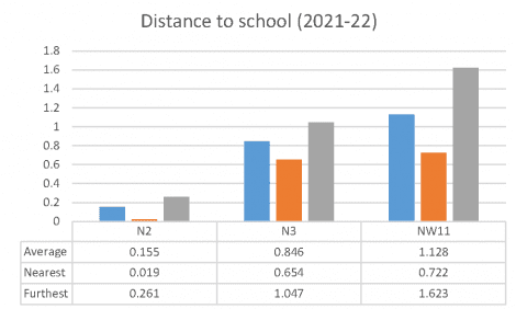
The three maps show the area of students coming to the school from each priority postcode – one map for N2, one for N3 and one for NW11. They do not show a specified catchment area, but rather the location of students in the current year only. As such they should be taken only as a guide to future admissions as this will be determined by the location of applicants and their preferences.
N2
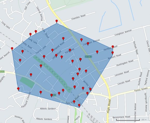
N3
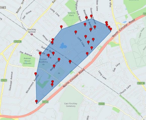
NW11
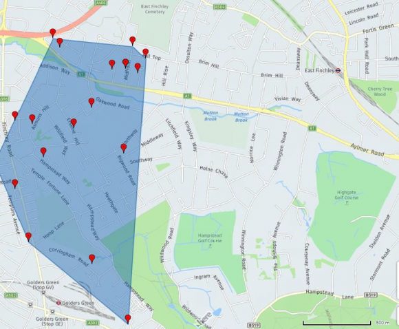
Supporting notes
Whilst every effort has been taken to ensure the accuracy of published data, the school does not accept liability for any inaccuracies or omissions included.
